 |
| Zavodovski as of 1st November 2016 emitting a gas plume with some possible slight ash content. SOURCE: Terra/MODIS/NASA. |
Sunday, 6 November 2016
Gas emissions continue on Zavodovski
Plumes drifting from Mount Curry on Zavodovski Island continue to be visible in satellite images during various days. It's likely that they are gas emissions although I wouldn't rule out the possibility of the odd plume having some slight ash content in it.

Sunday, 16 October 2016
Gas emissions on Zavodovski
Between 17th September to 10th October 2016, satellite images picked up a gas plume during various days drifting from Zavodovski Island. Here is an example image below.
 |
| Gas plume from Zavodovski on the 3rd October 2016. SOURCE: Aqua/MODIS/NASA. |
Sunday, 2 October 2016
Suspected ash plume from Saunders Island
In the satellite image from 14th September 2016, a faint dirty looking plume which appears to be originating from Mount Michael is present drifting northeast. This could possibly be an ash plume dispersing, or just simply a gas emission but I'm not 100% sure.
 |
| What appears to be a possible dispersing ash plume from Saunders Island on 14th September 2016. SOURCE: Terra/MODIS/NASA. |
Thursday, 1 September 2016
Clear image at last of Bristol Island and also Saunders Island
Clear images of the South Sandwich Islands from the 21st August 2016 have been released on the EOSDA website, and because it shows a clear view of the islands I was able to truly observe the changes on Bristol Island and I also discovered a thermal anomaly inside the crater of Mount Michael on Saunders Island.
First of all, in the image of Bristol Island a lava field is visible extending towards the west and north-northwest of Mount Sourabaya. The western part looks like it was starting to get frozen over while the north-northwest part of the lava field looks more darker. A steam emission originating from the crater of Mount Sourabaya is also visible. Although the lava appears to retain heat, it is not easy to truly tell whether the eruption has ended all together or if it's still in the last effusive stages.
Meanwhile in the infrared image of Saunders Island, a thermal hotspot is visible inside the summit crater of Mount Michael. This could either mean some low level eruptive activity is taking place, or there's simply high temperatures present inside the crater.
First of all, in the image of Bristol Island a lava field is visible extending towards the west and north-northwest of Mount Sourabaya. The western part looks like it was starting to get frozen over while the north-northwest part of the lava field looks more darker. A steam emission originating from the crater of Mount Sourabaya is also visible. Although the lava appears to retain heat, it is not easy to truly tell whether the eruption has ended all together or if it's still in the last effusive stages.
 |
| Clear image view showing the new lava field on Bristol Island. SOURCE: Landsat Viewer/EOS Data Analytics. |
 |
| Close up view of the new lava field on Bristol Island. SOURCE: Landsat Viewer/EOS Data Analytics. |
Meanwhile in the infrared image of Saunders Island, a thermal hotspot is visible inside the summit crater of Mount Michael. This could either mean some low level eruptive activity is taking place, or there's simply high temperatures present inside the crater.
 |
| Infrared image of Saunders Island showing thermal anomaly inside the crater of Michael Volcano. SOURCE: Landsat Viewer/EOS Data Analytics. |
Tuesday, 30 August 2016
Possible eruption on Zavodovski
It appears an eruption may have occurred yesterday on Zavodovski Island's Mount Curry volcano. If you look at the satellite image from 29th August 2016 you will notice a plume originating from Mount Curry and drifting in a east-northeasterly direction, and has a little greyish colour in it. In my view, it's likely to be an eruption plume or at least an ash and gas emission.
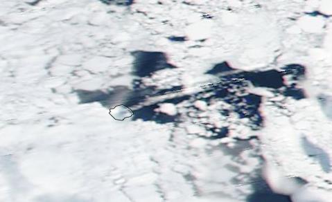 |
| What looks to be a possible eruption on Mount Curry as of 29th August 2016. SOURCE: Suomi NPP/VIIRS/NASA. |
Monday, 22 August 2016
Activity update 22/8/16: Bristol Island, Saunders Island
The eruption of Mount Sourabaya on Bristol Island appears to have ended or at least is in it's dying stages. A hazy Landsat 8 image from 21st August 2016 shows nothing more than dark patches with a little bit of steaming (indicating lava flows) and a thermal image revealed that the thermal anomaly over the lava field area wasn't so strong. This could indicate that the eruption of Mount Sourabaya has either ceased or may be in it's dying stages. A faint thermal anomaly is also present inside another crater to the east of Mount Sourabaya indicating possible elevated ground temperatures.
Meanwhile over on Saunders Island, a Landsat 8 image from the 21st August 2016 shows a steam plume being emitted from the summit crater of Mount Michael and drifting in a northerly direction. There's also what appears to show an enlargement of the crater caused by the collapse of an area between the summit crater and the "Old Crater" resulting in what possibly looks to be the two craters merging into one.
 |
| Satellite image of Bristol Island on the 21st August. SOURCE: Landsat 8/USGS/NASA. |
 |
| Thermal image of Bristol Island on the 21st August. Has the eruption ceased? SOURCE: Landsat 8/USGS/NASA. |
Meanwhile over on Saunders Island, a Landsat 8 image from the 21st August 2016 shows a steam plume being emitted from the summit crater of Mount Michael and drifting in a northerly direction. There's also what appears to show an enlargement of the crater caused by the collapse of an area between the summit crater and the "Old Crater" resulting in what possibly looks to be the two craters merging into one.
 |
| Saunders Island on the 21st August. SOURCE: Landsat 8/USGS/NASA. |
Sunday, 21 August 2016
Two Strong earthquakes hit South Georgia/South Sandwich Islands region
In the space of 2 days, two strong earthquakes over the magnitude of 6 has hit an area to the northwest of the East Scotia Ridge between South Georgia Island and the South Sandwich Islands. The first quake struck with a magnitude of 7.4 on the 19th August 2016 at 07:32 UTC with a depth of 10km, and then on the 21st August 2016 a second quake struck the same area with a magnitude of 6.4 at 03:45 UTC also with a depth of 10km.
 |
| 7.4 magnitude earthquake on 19th August 2016. SOURCE: USGS. |
 |
| 6.4 magnitude earthquake on 21st August 2016. SOURCE: USGS. |
Subscribe to:
Posts (Atom)